3 Stunning Highlights of the Flims Caumasee Crestasee Hike (An Unforgettable Graubünden Adventure)
Hiking Experience In Graubünden
Flims is a beautiful town in the Canton of Graubünden. We wanted to do a moderate hike and while searching online came across this gem. We reached Flims, parked our car in a parking lot and started our hike. We did the Flims to Caumasee and Crestasee hiking trail, which turned out to be an incredible experience. The hike was 9.8 kilometres long and took us more than 3 hours to complete.
In this blog, we will discuss the 3 stunning highlights that made this journey so unforgettable.
Disclaimer: This post contains affiliate links. If you make a purchase through these links, we may earn a commission at no extra cost to you.
📸 Image Rights: All photos are our own. Please contact us for permission to reuse.
Arriving in Graubünden
- Via Train or Bus: Graubünden is well-connected by rail via Chur from Zurich and St. Gallen, and by the scenic PostBus network through the mountain passes. To check schedules and book your ticket, use the Busbud platform here.
- Via Flight: Fly into Zurich Airport (the closest international gateway) and take a direct train into the mountains to experience the majestic Swiss Alps and the stunning Engadin Valley. To find the best deals on airfare, search and book your flights here.
Getting Around and Staying in Switzerland
- Going Around:
- Taxis & Private Transfers Secure a reliable, fixed-price ride with professional drivers. Avoid the airport queues by booking in advance. Book your taxi/transfer here.
- Car Rentals Enjoy the freedom of the open road. Compare the best rates from top brands to find your perfect vehicle here.
- Public Transport Travel like a local and save money. Skip the station lines by securing your train and bus tickets here.
- Stay Connected: To navigate the city like a local and share your photos in real time, we recommend getting an eSIM. Pick the option that suits your needs:
- We recommend Airalo for a budget-friendly and basic plan. Get your Airalo eSIM here.
- Yesim is our top-pick for unlimited data needs. Get your Yesim eSIM here.
- Where to Stay: To make the most of your trip, I recommend booking one of these hotels.
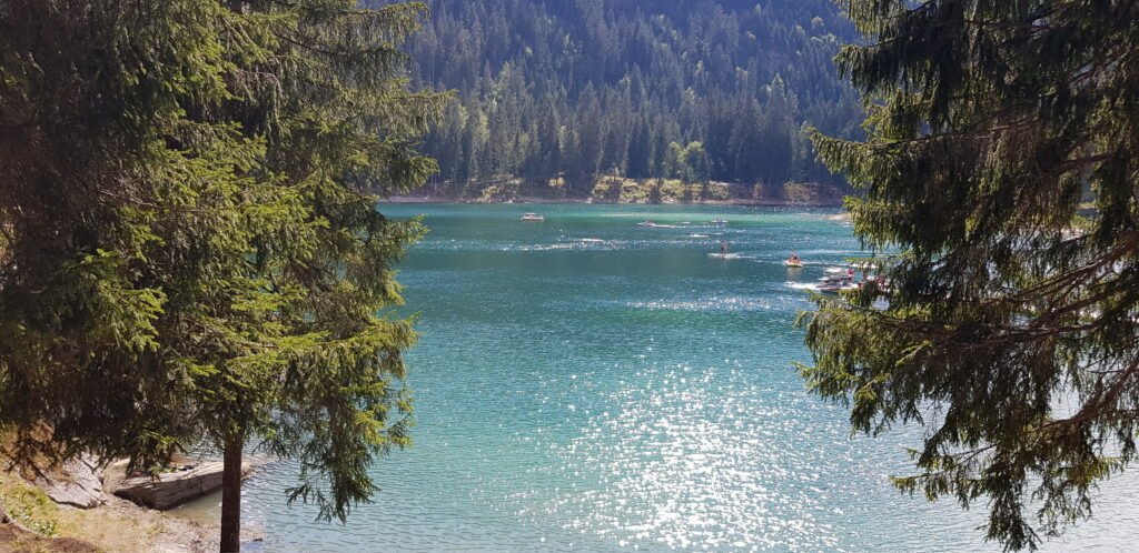
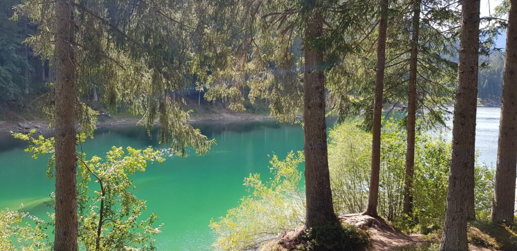
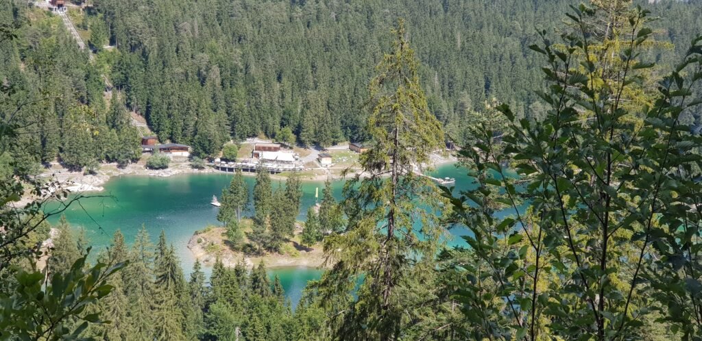
1. The Dual Lake Experience: Caumasee and Crestasee
The absolute highlight of this trail is that it links two of the most beautiful alpine gems in the region. Walking the Flims, Caumasee, and Crestasee route allows you to experience the changing scenery between both waters, making the journey feel like a true exploration.

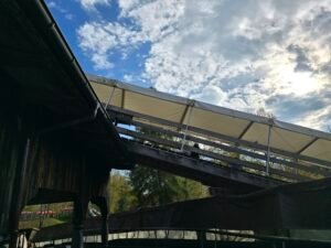
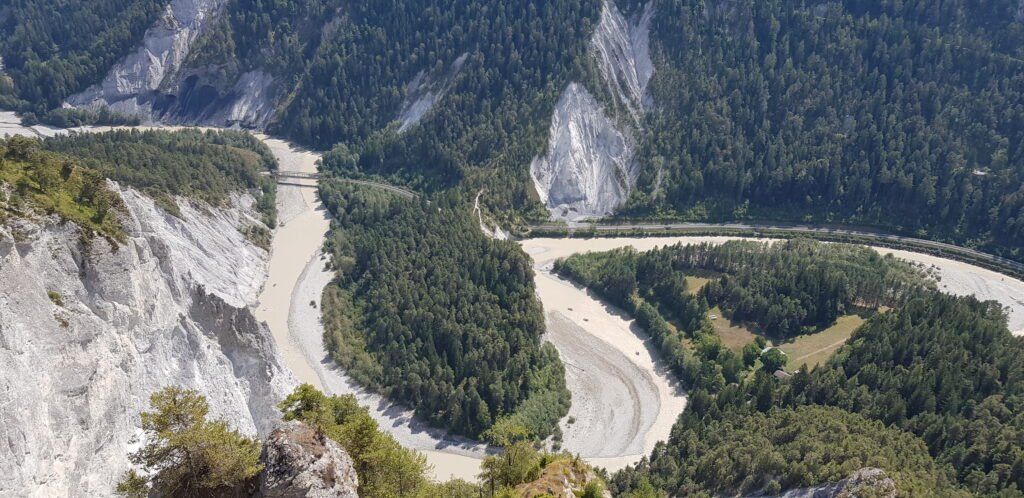
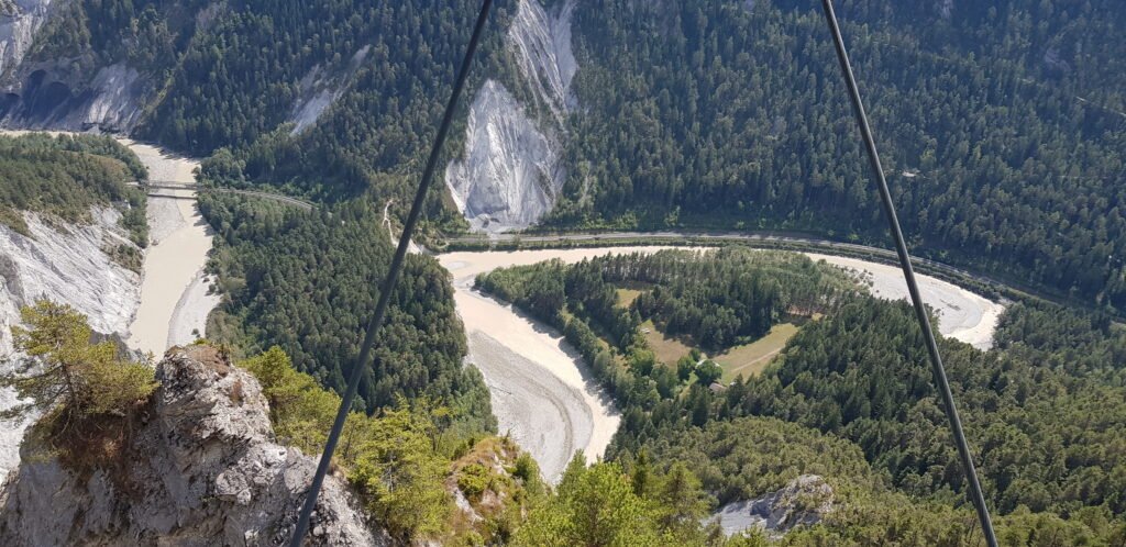
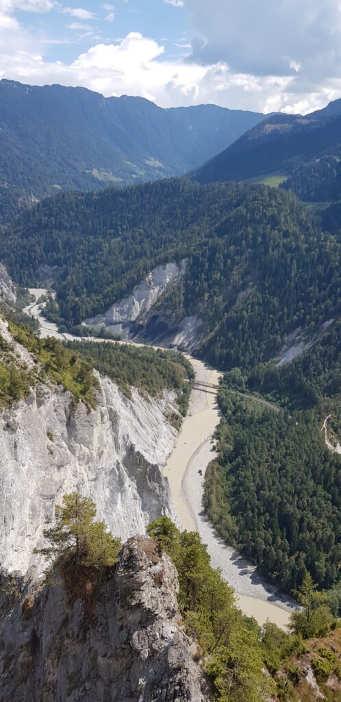
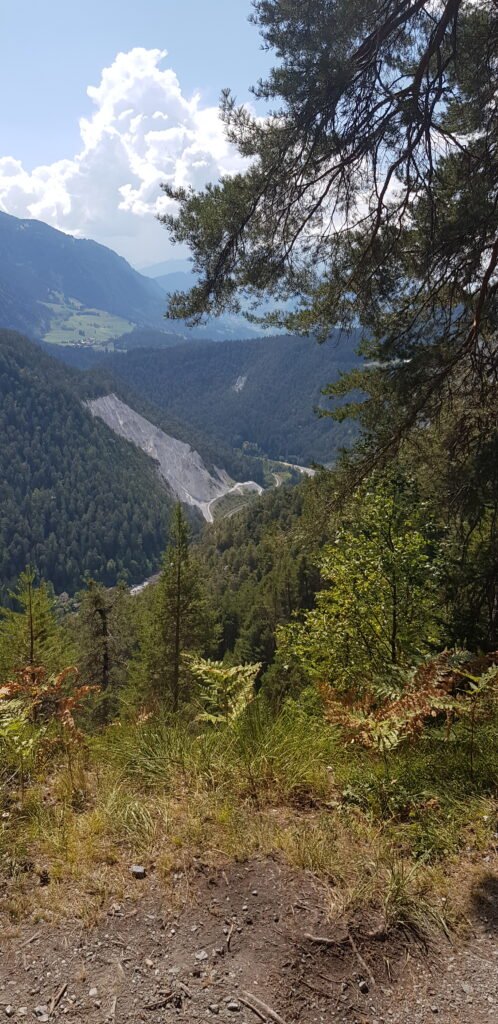
2. The Spectacular Viewing Platform
Along the trail, there was a stunning viewing platform called Il Spir near Conn. It provided an awesome view of the lake, the deep gorges, and the surrounding mountains from high above. It is the perfect place to stop, take a breath, and admire the majestic Swiss landscape.
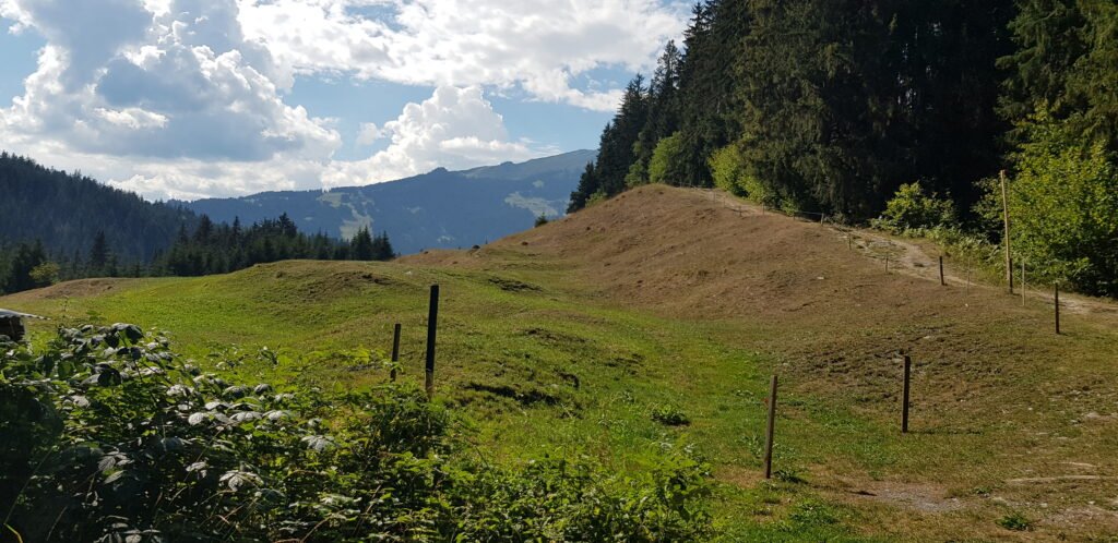
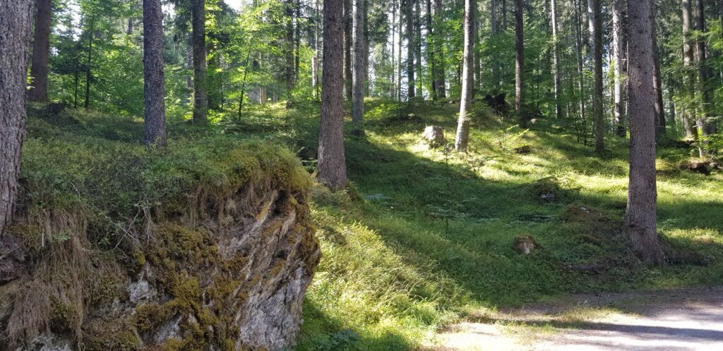
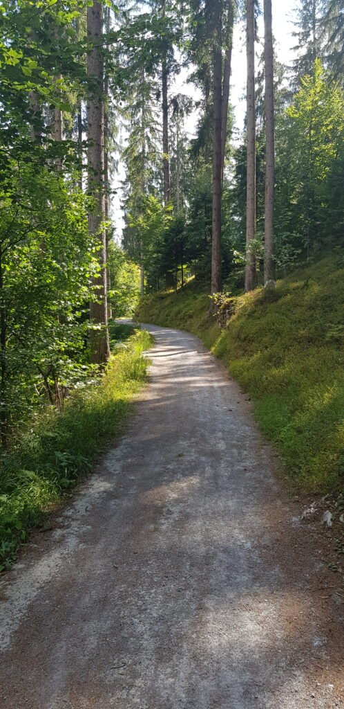
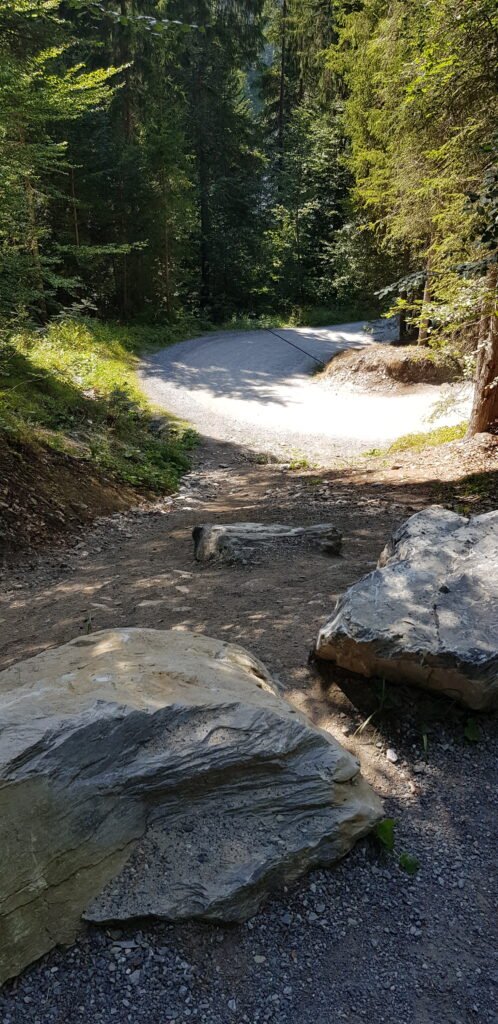
3. The Perfectly Balanced, Moderate Terrain
The difficulty of the hike was average, making it an excellent choice for anyone looking for a rewarding day out without being overly exhausting. The path keeps you engaged and it got a little challenging only on inclines, which added a perfect touch of adventure to the walk.
Final Remarks
The hiking experience at Flims was nothing short of adventurous. We had a blast and the views of the mountains and lakes were well worth the effort. However, this hike is definitely not suitable for families with little kids.
Found our hiking experience at Flims useful? We’d be happy to build a personalized itinerary just for you! Head over to our Custom-Plans page to get started.
If you are looking for travel essentials, check out our Resources section for hand-picked products that make travel stress-free.
Frequently Asked Questions
How long does the Flims to Caumasee and Crestasee hike take?
The full trail is about 9.8 kilometres long and generally takes a little over 3 hours to complete at a moderate pace, depending on how long you stop to enjoy the views.
Is there parking available at the trail start?
Yes, there are paid public parking lots available in Flims, such as the Parkhaus Flims Waldhaus, which serves as an excellent starting point for the route.
What is the viewing platform called on this route?
The famous viewing platform on this trail is called Il Spir, located near Conn. It offers spectacular 180 degree panoramic views over the Ruinaulta, also known as the Swiss Grand Canyon.